 Kauai Helicopter Ride
Home › Guides › Mount Waialeale: Can You Fly Into the Crater on a Kauai Helicopter Tour?
Mount Waialeale: Can You Fly Into the Crater on a Kauai Helicopter Tour?
Mount Waialeale is the peak at the center of Kauai, and for almost every visitor the way to see its crater is on Kauai helicopter tours that fly to its walls. This guide covers whether a helicopter can fly into the crater, whether you can drive or hike there, how much rain the mountain gets, why it is so wet, which flights cover it and when to fly. The quickest option is the Jack Harter Heart of the Island Doors-Off Flight, 18 minutes into the Waialeale crater for $235 per person. Full-island flights that include the mountain run 50 minutes to 1.5 hours, from $335.70 to $489 per person. The summit is often in cloud, so no operator promises the crater view.
Quick answer Can a helicopter fly into the Mount Waialeale crater?
Yes, a helicopter can fly into the Mount Waialeale crater: the Jack Harter Heart of the Island Doors-Off Flight spends 18 minutes going into it for $235 per person. Longer island flights that include the mountain cost from $335.70 per person. None of the flights listed lands at the summit. Ground access is extremely difficult, so the air route is the realistic option for most visitors.
Key takeaways
- The shortest crater flight is the Jack Harter Heart of the Island Doors-Off Flight, 18 minutes for $235
- For the crater plus the coast, the Safari Deluxe Waterfall Helicopter Tour covers Waialeale on a 55-minute route
- Morning flights give the best odds of a clear summit, see the best time for a helicopter tour in Kauai
- Read the Kauai helicopter crash record to see why pilots turn back for cloud
Can a Helicopter Fly into the Mount Waialeale Crater?
Yes, helicopters fly into the crater and along its Weeping Wall, but none of the flights listed touches down inside it.
A helicopter can enter the crater bowl. A landing is a different matter, and here is what the flights actually do.
What the flight actually does
Mount Waialeale sits at the southeastern edge of an extinct caldera now called Alakai Swamp, part of a central mountain mass that also holds Kawaikini, the island's highest peak at 5,243 feet. Tour routes bring you into the bowl and along the wall of waterfalls known as the Weeping Wall. The Jack Harter Heart of the Island Doors-Off Flight is built around it: 18 minutes in a four-passenger MD500 with the doors off. The only landing among the flights listed is in Olokele Canyon, on the 1.5-hour Safari tour, not in the crater. Federal rules keep Hawaii air tours at least 1,500 feet above the surface except for takeoff, landing or ATC-cleared segments.
The mountain is usually tucked behind a shroud of wispy rain clouds, so some flights turn back if the summit is socked in. Book early in the day and keep a flexible morning in your plan.
Why flying beats walking
Access by foot to the Waialeale area is extremely difficult because the ground is so wet. The Alakai Wilderness Preserve is boggy, trailless country. Only a handful of very fit hikers ever get near the summit.
From a helicopter you see the walled valleys over 3,000 feet deep that funnel moisture into the peak, something no trail view gives you. Even the 18-minute crater flight shows more of the bowl than a full day on foot.
Sources: USGS, eCFR Federal Regulations.
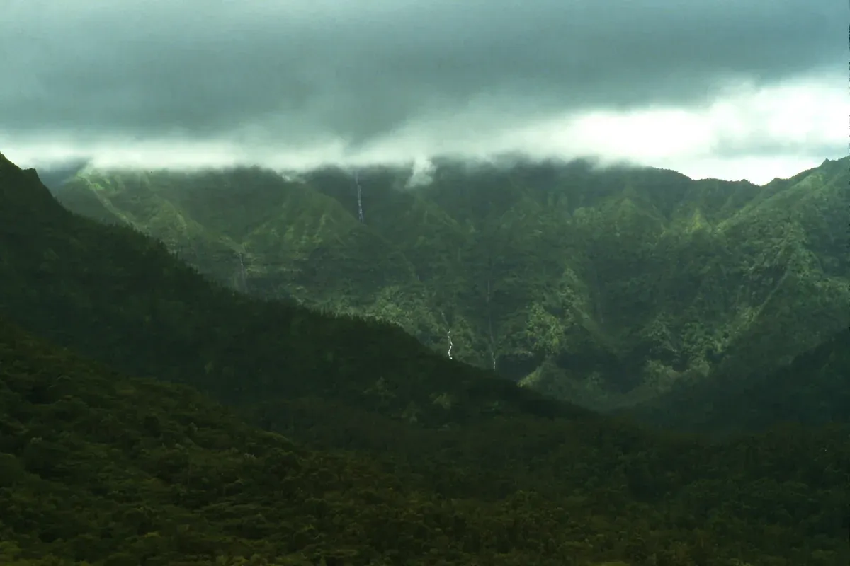
Mount Waialeale is among the wettest places on Earth and its crater is often hidden in cloud. Photo: rjones0856, CC BY 2.0, via Wikimedia Commons
Can You Visit Mount Waialeale, or Drive to the Summit?
You cannot drive to the summit, and visiting on foot means a hard, risky 6.2-mile roundtrip hike that starts with a 4WD road, so almost every visitor sees Mount Waialeale from the air.
The two most common questions about the mountain both get the same answer, with one narrow hiking exception.
Driving
There is no road to the summit. The closest vehicle access is the end of Loop Road (Kuamoo Road) in Wailua, the trailhead for the Weeping Wall route, and that road requires a high-clearance 4WD vehicle and crosses a stream three times. From there you are still walking, not driving.
Visiting on foot
The Weeping Wall (Blue Hole) hike is 6.2 miles / 10.0 km roundtrip and can take from 1.5 to 3 hours each way or longer. There is no cell phone service on any part of the trail, and it should not be attempted if the stream appears to be flooding. Beyond this route, foot access through the boggy Alakai Wilderness Preserve is extremely difficult.
For a realistic trip, treat the mountain as an air sight. Book one of the Kauai helicopter tours that covers the island's interior, and spend your ground time at places with real access such as Waimea Canyon.
Sources: USGS, Hawaii State Parks.
Where Is Mount Waialeale?
Mount Waialeale stands in the middle of Kauai, a short flight west of Lihue. The 18-minute Jack Harter flight goes only there, the island tours include it weather permitting.
- 1 Lihue AirportMost flights take off from the heliports and commuter terminal here.
- 2 Mount Waialeale craterOne of the wettest places on Earth, 373 inches a year on average from 1949 to 2008.
- 3 Wailua FallsAbout 80 feet in two streams, on the way from Lihue.
Numbers match the pins on the map.
Source: U.S. Geological Survey.
How Much Rain Does Mount Waialeale Get?
The USGS gives Mount Waialeale an average of 373 inches of rain a year from 1949 to 2008, and the National Weather Service puts the 30-year average just below 384 inches in 2010.
Rainfall figures for the mountain vary by source and by period. These are the official ones.
The Official Numbers
The table below compares the official rainfall records for Mount Waialeale from the USGS and the National Weather Service. The USGS reports an average of 373 inches a year for 1949 to 2008. The National Weather Service says the 30-year average fell from 406 inches in 1997 to just below 384 inches in 2010, and the driest year on record was 1993 with 244.36 inches.
For comparison, NOAA recorded 43.01 inches at Lihue Airport in 2023.
| Measure | Figure | Source |
|---|---|---|
| Average, 1949 to 2008 | 373 inches a year | USGS |
| 30-year average in 1997 | 406 inches | National Weather Service |
| 30-year average in 2010 | just below 384 inches | National Weather Service |
| Driest year, 1993 | 244.36 inches | National Weather Service |
| Lihue Airport, 2023 | 43.01 inches | NOAA |
Sources: USGS Water Science School, NOAA, NOAA NCEI.
Is Mount Waialeale the Wettest Place on Earth?
The USGS calls it one of the wettest places on Earth, but Mawsynram in India has a higher recorded average and Big Bog on Maui was wetter within Hawaii from 1978 to 2007.
Call it one of the wettest places on Earth and you will be right. Here is how the claims sort out.
The Ranking
The table compares the average yearly rainfall of the spots most often named as the wettest, with the figure and the period each average covers. Per the Guinness Book of World Records, Mawsynram in India has a higher 38-year average of 467.4 inches. Within Hawaii, the wettest spot over 1978 to 2007 was Big Bog on Maui at 404 inches a year.
What Waialeale does hold is the dramatic one: a few miles from its summit, rainfall drops to about 10 inches a year, one of the steepest wet-to-dry gradients anywhere.
| Spot | Average | Rank |
|---|---|---|
| Mawsynram, India | 467.4 inches over 38 years | Wettest recorded average |
| Big Bog, Maui | 404 inches, 1978 to 2007 | Wettest in Hawaii in that period |
| Mount Waialeale | 373 inches, 1949 to 2008 | One of the wettest on Earth (USGS) |
Sources: USGS, USGS Water Science School.
Why Is Mount Waialeale So Wet?
The summit sits just below the 6,000-foot trade wind inversion layer, and steep walled valleys over 3,000 feet deep funnel moist trade wind air straight into it.
Geography does all the work. The mountain is a rain machine by position.
The mechanism
Moist trade winds hit the mountain and are forced up its walls. Because the summit sits just under the inversion layer at about 6,000 feet, the rising air clouds and rains out right at the peak instead of drifting past it. The name means rippling water or overflowing water, which fits. Kauai is the oldest and most eroded of the main Hawaiian Islands, which is why those deep amphitheater valleys exist here.
All that rain feeds the island you fly over: the 800-foot Waipoo Falls, Waimea Canyon, and the only navigable rivers in the state. The summit itself is relatively barren because few plants can handle that much rain.
Source: USGS.
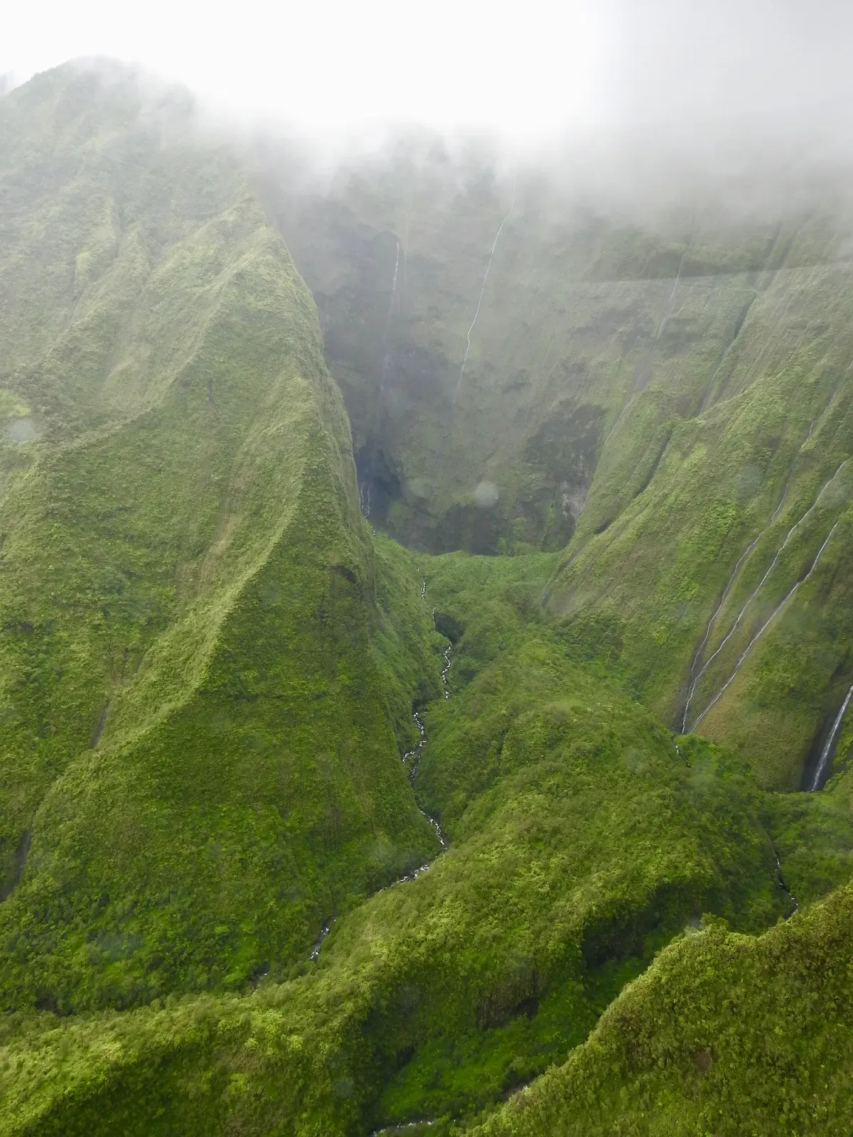
The walls of the Waialeale crater drop away into mist, the view helicopter pilots try to reach on clear days. Photo: RaptorWings, CC BY-SA 4.0, via Wikimedia Commons
Which Flights Fit a Mount Waialeale Trip?
These flights cover the island's interior and bring you to the Mount Waialeale crater, weather permitting.
 from $425
Top rated
Ali'i Private Doors-Off Helicopter Tour
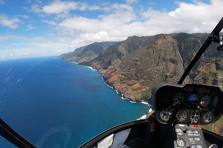
The top-rated flight here: a private doors-off helicopter for your party only, about 1 hour over Waimea Canyon, the Na Pali Coast and Waialeale.
Check Availability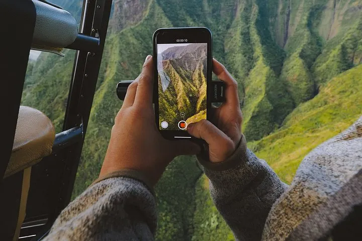 from $384
All window seats
Mauna Loa Private Doors-Off Helicopter Tour
A private doors-off flight with no middle seats, so every passenger sits at a window for 55 minutes over the canyon and the coast.
Check Availability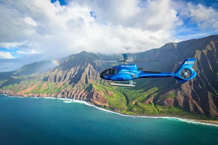 from $489
Most booked
Blue Hawaiian Eco Adventure Helicopter Tour
The most-booked Kauai helicopter tour: 50 minutes in a six-seat ECO-Star with business-class seats, headsets and a certified pilot guide.
Check Availability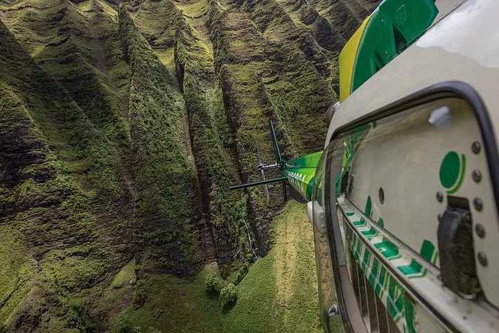 from $335.70
Best value
Safari Deluxe Waterfall Helicopter Tour
The lowest helicopter price on a full circle-island route: 55 minutes and 100-plus miles with the fuel surcharge already included.
Check AvailabilityWhich Kauai Helicopter Tours See Mount Waialeale, and What Do They Cost?
Flights from Jack Harter, Ali'i, Mauna Loa, Blue Hawaiian, Safari and Air Kauai include the mountain, at prices from $235 to $489 per person.
Nearly every helicopter route on Kauai crosses the island's center, so the mountain is standard on the longer flights. Compare before you book.
The Options
The table lists the helicopter flights that include Mount Waialeale, with the price per person and the flight length each one gives. The full side-by-side list of Kauai helicopter tours adds doors, weight rules and departure points. The Jack Harter Heart of the Island Doors-Off Flight is the crater-only option at 18 minutes.
Doors-off flights give the best photography of the Weeping Wall. Safari Helicopters requires an extra seat for guests over 250 lbs, or two guests together at 420 lbs.
| Tour | Price per person | Duration |
|---|---|---|
| Jack Harter Heart of the Island Doors-Off Flight | $235 | 18 minutes |
| Safari Deluxe Waterfall Helicopter Tour | $335.70 | 55 minutes |
| Mauna Loa Private Doors-Off Helicopter Tour | $384 | 55 minutes |
| Safari Helicopter Tour with Olokele Canyon Landing | $369 | 1.5 hours |
| Air Kauai Doors-Off Helicopter Tour | $402.09 | 50 minutes |
| Ali'i Private Doors-Off Helicopter Tour | $425 | 1 hour |
| Blue Hawaiian Eco Adventure Helicopter Tour | $489 | 50 minutes |
Sources: iFly Kauai, Blue Hawaiian Helicopters, Safari Helicopters, Mauna Loa Helicopter Tours.
What Is the Weather Like at Mount Waialeale, and When Should You Fly?
The summit is usually tucked behind wispy rain clouds, so fly in the morning, keep a backup day, and expect the operator to reroute or cancel if the crater is clouded in.
Rain is the reason the mountain looks the way it does, and also the main reason a flight gets cut short.
Booking Around the Clouds
Hawaii has two seasons, summer from May to October and winter from October to April. At Lihue Airport NOAA recorded 43.01 inches of precipitation in 2023, with February the wettest month at 8.67 inches, and the mountain gets several times that. Weather in the interior changes fast, and pilots on Kauai rely heavily on their own visual weather assessments because terrain limits weather observation.
Practical plan: book an early flight and schedule the tour early in your trip so a weather cancellation can be rebooked. Every tour listed here offers free cancellation up to 24 hours ahead. More detail is in the guide to the best time for a helicopter tour in Kauai.
Sources: National Weather Service Honolulu, NOAA NCEI.
Are Kauai Helicopter Tours Safe Near Mount Waialeale?
Tours operate under FAA Part 136 rules, but the mountain is demanding terrain and the NTSB has investigated serious accidents, so treat the operator's weather call as final.
It is worth knowing the rules and the record before you fly into the wettest, cloudiest part of the island.
The Rules and the Record
FAA 14 CFR Part 136 Subpart D sets operating rules for VFR air tours in Hawaii. Tours may not fly below 1,500 feet above the surface over any area of the state, with exceptions for takeoff, landing and ATC clearances, and may not come closer than 1,500 feet to any person or property. Single-engine rotorcraft beyond the shore need flotation gear, and pilots must brief water ditching procedures before takeoff.
The NTSB has investigated several Kauai air tour accidents, including a 2019 crash near Kekaha caused by a pilot continuing visual flight into instrument conditions, and found that Hawaii terrain limits weather observation so pilots rely on their own visual assessments. The full list is in the Kauai helicopter crash record. The lesson for you: if the operator says the crater is not flyable today, believe them and rebook.
Sources: eCFR Federal Regulations, NTSB.
What Do You See Around Mount Waialeale on a Helicopter Tour?
One flight usually stacks the crater and Weeping Wall with Waimea Canyon, the Na Pali Coast, waterfalls and the North Shore valleys.
The mountain sits in the middle of the island, so routes to it pass a long list of other sights.
The Combined Route
From the crater the flight typically continues to Waimea Canyon, about 14 miles long and up to 3,600 feet deep, called the Grand Canyon of the Pacific. To the north run the Wainiha, Lumahai and Hanalei valleys, and the Na Pali Coast, a 16-mile stretch of cliffs where the 11-mile Kalalau Trail crosses five valleys. Kokee State Park gives views of Kalalau Valley from 4,000 feet if you want a ground backup for that sight.
Some routes add a landing: the Safari Helicopter Tour with Olokele Canyon Landing runs 1.5 hours for $369 per person and touches down in a canyon most flights only overfly.
Sources: Hawaii State Parks, Hawaii State Parks, Hawaii DLNR Division of State Parks.
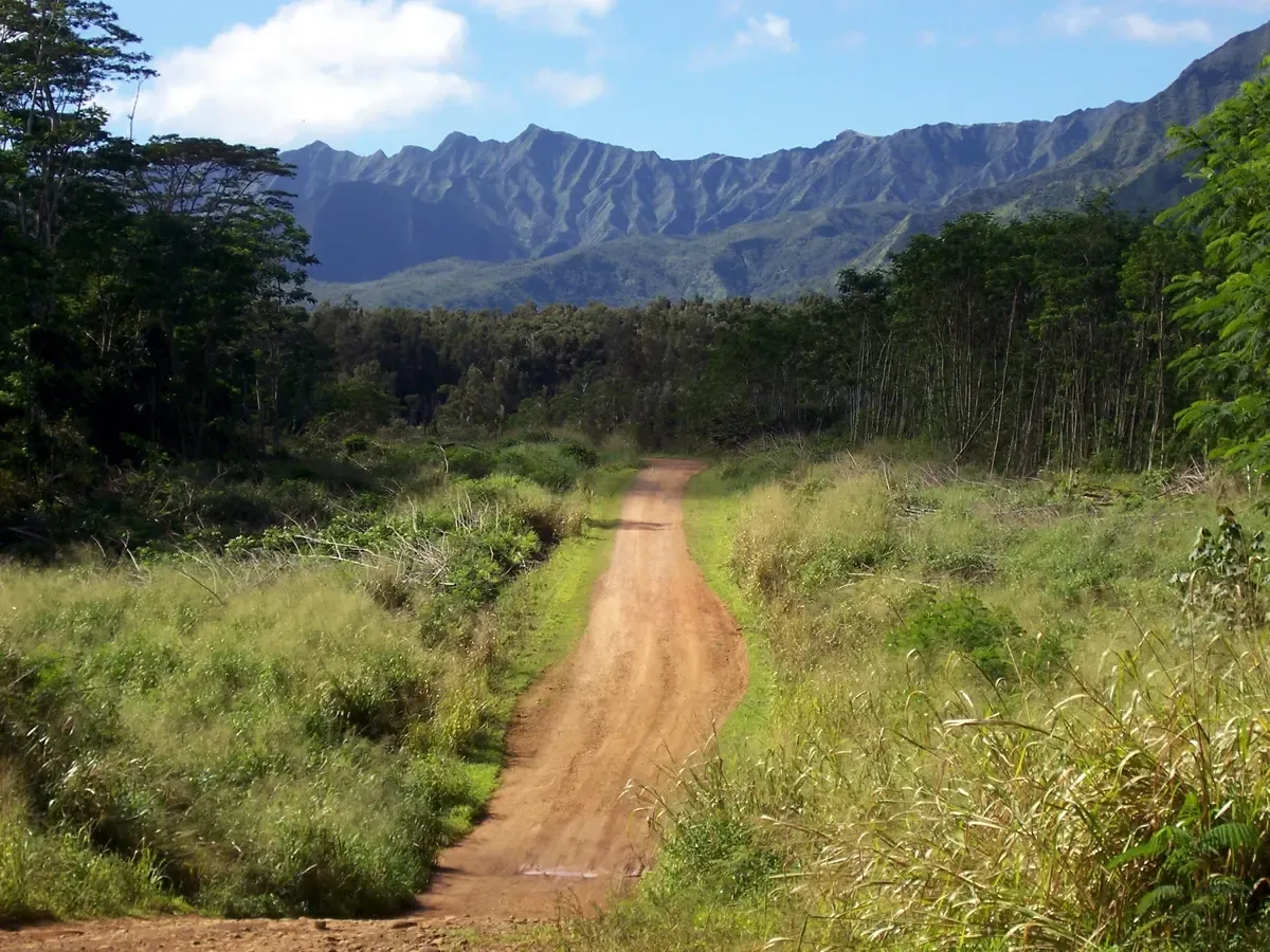
The Waialeale Basin road shows how the interior rises toward the summit ridge. Photo: Bryce Edwards from San Jose, CA, USA, CC BY 2.0, via Wikimedia Commons
Mount Waialeale FAQ
How do you pronounce Waialeale?
Say it Why-ah-lay-AH-lay, roughly five syllables. The name means rippling water or overflowing water, a fair description of a peak that averages 373 inches of rain a year. The quickest way to see it is the Jack Harter Heart of the Island Doors-Off Flight.
Can you visit Mount Waialeale?
Only by a hard hike. The Weeping Wall (Blue Hole) route is 6.2 miles / 10.0 km roundtrip, can take 1.5 to 3 hours each way or longer, starts with a 4WD road that crosses a stream three times, and has no cell phone service. For nearly every visitor the answer is to see it on Kauai helicopter tours instead.
Can you drive to Mount Waialeale?
No. There is no road to the summit. The only vehicle route goes to the Weeping Wall trailhead at the end of Loop Road in Wailua and requires a high-clearance 4WD. The 18-minute Jack Harter Heart of the Island Doors-Off Flight reaches the crater from Lihue instead.
Can you hike Mount Waialeale?
Not to the summit for practical purposes. Access by foot to the Waialeale area is extremely difficult because of the boggy Alakai Wilderness Preserve, and the Blue Hole trail is as far as most hikers should go. The Mauna Loa Private Doors-Off Helicopter Tour covers the crater in 55 minutes.
What is the Weeping Wall?
It is the amphitheater wall on Mount Waialeale where dozens of waterfalls trickle down the green rock after rain, draining the crater. It is the single best sight on an interior helicopter route. The Safari Deluxe Waterfall Helicopter Tour includes Waialeale on its 55-minute route.
What is there to do around Mount Waialeale?
Fly over it, then spend ground time at Waimea Canyon, Waipoo Falls and Kokee State Park, which give views of Kalalau Valley from 4,000 feet. The mountain's rainfall feeds all of them. A longer flight such as the Ali'i Private Doors-Off Helicopter Tour covers the crater and Waimea Canyon together.
Which family owns most of Kauai?
Land titles are outside the scope of a flight guide. For a visitor, the point is that the ground around Mount Waialeale is the Alakai Wilderness Preserve, with no road to the summit, so the crater is seen on Kauai helicopter tours.
Where not to stay in Kauai?
For a crater flight, avoid a base far from your departure point. Most tours listed leave from Lihue Airport or the Lihue heliport, while the Blue Hawaiian Helicopter Tour from Princeville leaves from Princeville Airport on the North Shore. Sleep near the one you book so an early flight is not a long drive.
More Guides
- What Is the Best Time for a Helicopter Tour in Kauai?
Morning flights give the clearest skies over Kauai in 2027. See the season table, tour prices and booking tips, then pick your slot.
- Kauai Helicopter Crash Record: How Safe Are Kauai Helicopter Tours?
Three people died in the 26 March 2026 Kauai helicopter crash near Haena. See the 2027 accident record and how to choose a Kauai tour.
- Blue Hawaiian Helicopters Kauai: Eco Adventure and the Princeville Flight
Blue Hawaiian Kauai helicopter tours in 2027: 50 and 45 minute flights over Na Pali and the Jurassic Park falls. Compare both routes and book.